|
Experiential learning resources for the innovative educator
I am never the most tech-savvy person in the room. There is so much out there and it's always evolving. It's tough to know where to start and just when I feel I've gotten it, everything changes.
Education technology can be intimidating and time-consuming to learn. Time isn't something teachers have in abundance. But it gets easier and more user-friendly everyday, and Google Maps is one such tech that PBL students can highly benefit from. 
One tech tool that I have been using with my students for years is Google Maps. I have really stuck by this program as an ed tech tool because it is user-friendly. That is a win for those of us that feel a little overwhelmed with technology at times. It's a fantastic learning tool and a great way to showcase student work.
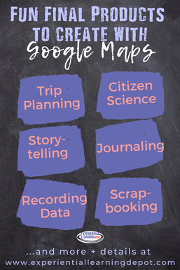
I have used Google Maps as a project final product option for many of my class project-based learning activities. So if you're feeling overwhelmed by technology AND self-directed project-based learning, Google Maps is a great way to go. Maps can be used for obvious projects such as trip planning, but it can also be used in some unexpected ways such as storytelling, scrapbooking, and data collection for science experiments. If you're not very familiar with self-directed project-based learning, I encourage you to check out these blog posts before moving on:
Benefits of Using Google Maps in Project-Based Learning 1) It's an innovative final product - A lot of projects end with poster boards. One problem with poster boards is that they tend to be cut and paste. There's little engagement depending on how they're used. Putting information into Google Maps requires a certain degree of inquiry and problem-solving. 2) The final product is shareable - one of the important principles of project-based learning is sharing the information with an authentic audience: relevant and public. You can easily share your Google Map by sharing the link via social media, embedding it in a website or blog, and personally inviting specific people by email to view it. 3) Encourages community collaboration - Another important principle of project-based learning is getting the community involved by utilizing experts in the field and creating a usable final product that is of benefit to the community. Creating a usable map for others to use is ideal. Let's say a student creates a tour on Google Maps. Once the map is published, anyone looking to take a tour in that specific area could use the map as a guide. 4) A tool for developing 21st-century skills - Technology is around. It's a part of life now. For students to be successful in the 21st-century workplace, I personally believe that we need to embrace technology and help our students learn how to navigate it. Google Maps is a great way to effectively utilize technology in the classroom as well as pose the opportunity to practice problem-solving, critical thinking, flexibility, collaboration, communication and so on.
Google Maps Features:
The following features are utilized regularly by my students for self-directed project-based learning end products. 1) Create routes and alter them: Students could design a tour for example, and map out their route for the day. If there is an alternative route that they want to take, students can simply move the line that Google Maps created between two destinations to fit their needs.
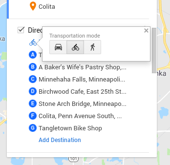
2) Plan routes by bike, car, and foot: Students can choose their mode of transportation and Google Maps will automatically find the best route.
For example, Minneapolis has an elaborate trail system throughout the city. If you choose "bike" as your mode of transportation, Google Maps will lay out the safest and most efficient bike route using the trails whenever possible.
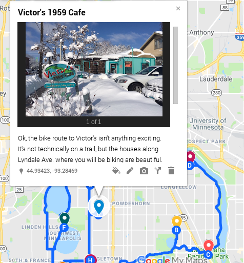
3) Add pins with photos and descriptions: Let's say a student is planning a trip. They can throw down markers/pins to places they want to visit on their trip and add details to those pins by creating a photo card. Descriptions and photos can be added to every pin.
4) Add layers: Students can add layers to their maps. One reason to use the layers feature would be to add itineraries for multiple days.

5) Measure distance: There is a ruler tool to measure the distance between two points. This is helpful for gauging how much time to set aside for commuting, among other things.
6) Add directions: You can choose to add directions between pins if you wish. The directions will show up as blue lines between pins. Viewers can also get step-by-step written directions. 7) Share your final product: Because your map is online, it receives its own unique link once you have published it. That link can be shared on any digital platform. You can also embed a code to your map into any website or blog. Finally, you can invite specific people to view your map and collaborate if you wish. This last part would be helpful for feedback from a teacher, peer, or community expert (an important element of PBL.) 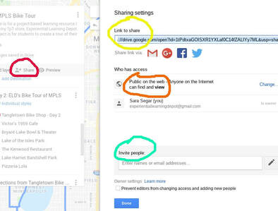
Fun Ways to Use Google Maps in Project-Based Learning
The following is a list of ways I have used Google Maps in project-based learning. You can use these ideas to design a project that ALL of your students do. You could also allow students to design and lead their own project-based learning experiences.
This style of self-directed project-based learning allows students to choose their project topic, how they will gather information, how they will demonstrate learning, etc. Check out my free self-directedproject-based learning implementation spreadsheet. Use this Google Sheets to organize yourself and your students projects. 
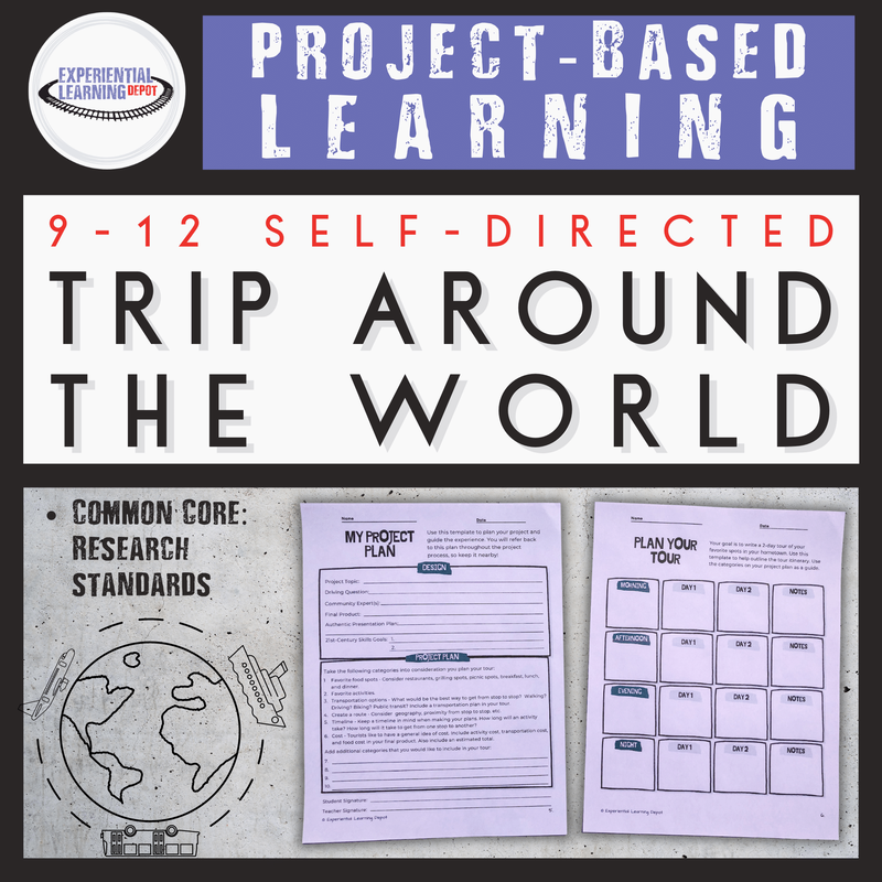
1) Plan a real or hypothetical trip
My students plan trips all of the time whether they actually go on them or not, and they love using Google Maps to do it. is a project that my students do every year. My students have created hypothetical trips around the world and hypothetical road trips (some of which we ended up actually taking). 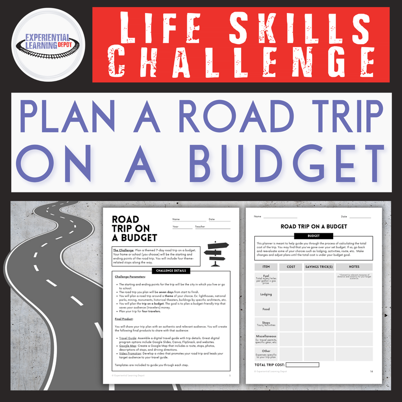
2) Plan a real trip itinerary
Students could create a Google Map outlining their itinerary for a trip. My school is travel-based, so my students have created Google Maps of actual trips that they've taken with the school. You could also assign this project to students as a theoretical trip or even as a family trip, especially if you're homeschool traveling family. I have a variety of educational travel resources that I encourage you to check out.
3) City scavenger hunt Students can create a scavenger hunt around the town or city using a Google Map as their guide. Our school is located right in front of the light rail, which connects Mpls and St. Paul. A coworker of mine created a scavenger hunt for students to get better acquainted with public transportation. That is one example and something a student could do. 4) Storytelling or content sharing A Google Map could be created to demonstrate learning of content knowledge in place of a more standard end product such as a poster board or Powerpoint. For example, if a student is doing a project on art history, they might create a Google Map with the locations of some of the most famous art pieces around the world. They would add descriptions or content info that they have gathered through research to their Google Maps photo cards. 5) Map out a story that has already been written A few of my students did this for the Serial Podcast. The first season is about a murder in a suburb of Baltimore. The setting is critical to the storyline. Several of my students created their own Google Maps of the crime scene and other relevant locations to the case to demonstrate comprehension as well as analyze evidence from the case. 6) Map out your own story My advisory students tell their own story through Google Maps as a beginning of the year "get-to-know-you" activity. They map out their past such as where they have lived and specific places that have played an important role in their lives. They include in their map where they are today and where they hope to be in the future. 7) Creating a scrapbook of a vacation I have mentioned creating a Google Map of a trip plan, but a Google Map could also be created as a reflection to a trip already taken. Students can drop pins at the places they visited and add photos and captions describing the experience they had, much like a scrapbook. 8) Use "time travel" to analyze how neighborhoods have evolved There is a feature of Google Maps called "time travel" that came out in 2014. This feature allows you to look at how things have changed over time at any given location. Students could analyze neighborhoods to see how they've evolved over time. 9) Use Google Maps to record data You can drop a pin and add descriptions anywhere on a map. Therefore, students that are conducting experiments outdoors could drop pins and add observations to Google Maps similar to what one would do in a field notebook. For example, I did biodiversity surveys with my bio students in Minnesota and then again when we traveled to Costa Rica. We could drop pins at every location that we surveyed and add our biodiversity count to each pin under the description. 10) Be a citizen scientist! There is something called "treks" on Google Maps where you can "off-road". You can see places that you can't see from a typical snapshot such as Angkor Wat or the canals of Venice. Google needs people to get these off road views by taking photos and submitting them to the database, a type of citizen science. If travel is part of your curriculum, you might want to look into this. This would be a great ongoing project for worldschoolers. 11) Map a journey or timeline Students can use Google Maps to illustrate historical movement. For example, my students and I read the book "What is the What" about the lost boys of Sudan. My students tracked the movement of the lost boy refugees on Google Maps over the course of reading this book. This is a common end product for looking at the movement of a human or animal population over time. 12) Plan a hometown tour This is my favorite project for using Google Maps because it really excites and engages my students. It is relevant to their lives, it is personal, and they take pride in their final product. The project is for students to create a tour of their own hometown. They create a 2-day itinerary and map it out on Google Maps. They can then share their map with the public. Save time and grab your own copy of this resource - Self-Directed Project-Based Learning: Create a Hometown Tour I created my own hometown tour of MPLS using Google Maps. My tour is very personal to me, as it would be for each of your students. Check out my tour below as an example of a final product using Google Maps. You can move the map around and click on the pins to see my photo cards with descriptions and photos. To go directly to the tour, click here.
Minneapolis Bike Tour Project-Based Learning Example
Check out this tutorial on how to create a tour on Google Maps. Your Students can easily access this "how to" on Youtube.
I would LOVE to add student projects to my blog. If you use any of my resources in your classroom or homeschool, OR if you have your own projects for students that use Google Maps, I would love to showcase student work right here. If you use Google Maps in your curriculum in a way that wasn't mentioned in this post, please share in comments. I'd love to hear more ideas!
Follow Experiential Learning Depot on Pinterest, Facebook, Youtube, and Instagram for more on experiential education, and check out my TpT store for experiential learning resources. Did you know there is an experiential learning Facebook group? Check that out - Experiential Learning Community for K12 Teachers - and join in the discussion about experiential learning, including fun ways to create final products. Let's work together! Click the links below to learn more:
2 Comments
Patty Sanchez
11/16/2020 05:04:53 pm
Thanks for this great assignment! I will use this in my adult ed class.
Sara (Experiential Learning Depot)
11/16/2020 09:02:50 pm
I’m so glad, Patty! I would love to hear about your students’ experience if you’re willing to send over an email! Good luck to you. Your comment will be posted after it is approved.
Leave a Reply. |
Blog IntentTo provide innovative educational resources for educators, parents, and students, that go beyond lecture and worksheets. AuthorSara Segar, experiential life-science educator and advisor, curriculum writer, and mother of two. 
Categories
All
|

 RSS Feed